Parang is a 2nd class coastal municipality of Sulu Province in Bangsamoro Autonomous Region, Philippines.
Profile of Parang Municipality (Geography)
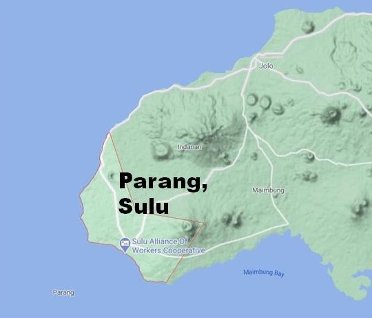
Location –> Western part of Jolo island, West of Mindanao Island (See map below)
Neighboring Towns –> Indanan and Maimbung (east)
Area –> 258.00 km2 (99.61 sq mi)
Population –> 62,172 (2015 Census)
Revenue (2016) –> 119,453,164.01
Barangays –> 40
Terrain –> Coastal Plain with hills
Industries –> Agriculture, Trading, Tourism
Major Products –> Rice, Fish, Vegetables, Poultry, Handicraft, Home-made Food Items
People/Language –> Tausug, Sama, Cebuano, Tagalog, English
Legislative District –> 1st
Government Officials
Congressman –> Samier Tan
Mayor –> Alkhadar T. Loong
Vice Mayor –> Madzhar T. Loong
History of Parang
The census of 1918 showed that there were 20,051 residents of Parang.
Economy of Parang
Parang is an agricultural town where rice, corn and fish are the major products.
Tourist Spots in Parang
Festivals in Parang
Map of Parang Municipality in Sulu Province
See also: Profile of Mayor Alkhadar T. Loong, Governor Abdusakur Tan